Etiqueta del plugin: GPX
-
-
WP GPX Maps – GPX, FIT & KML maps with elevation profile
Show your hikes, rides and runs from GPX, FIT, TCX or KML files on an interactive map with elevation profile, charts and route summary.
-
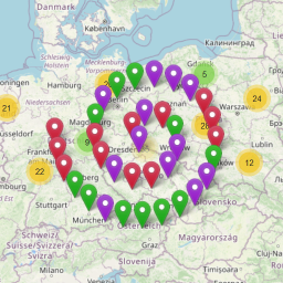
Extensions for Leaflet Map
Extends the WordPress Plugin Leaflet Map with Leaflet Plugins and other functions.
-
-
-
Lf Hiker
Lf Hiker is a plugin for quickly display your gpx tracks with their profile elevation on an interactive map.
-

GPX Route Map
Attach a GPX track to any post or page and render it as an interactive OpenStreetMap map with waypoints, distance and an elevation profile.
-
-

Spotmap
Live GPS tracking for WordPress — display positions from SPOT, Garmin inReach, OsmAnd, Teltonika, and more on interactive maps.
-
Images with GPS on GoogleMaps
Images with GPS on Google Maps displays your photos on a Google Maps map using GPS or without GPS Geotags.
-

Listdom KML Addon – Display KML Layers
Easily add KML (and GPX) map layers to your Listdom directory maps, highlighting specific areas, routes, or boundaries.
-

Mapthread
Transform your travel stories into interactive map experiences. Upload GPX files, place markers, watch the map follow as readers scroll.
-

WP Trip Summary
Structured trip summaries, self-hosted GPS tracks and interactive maps for travel bloggers.
-
-
-

BSPlaces
BSPlaces extends WordPress of simple gps position and gpx tracks management. Default visualization engine is api.mapy.cz.
-

Route Finder
Route management with interactive maps, destinations and filtering for cycling, hiking, walking, skiing and other outdoor activities.
-

PeakMaps
Leaflet map with GPX tracks, markers, elevation profile, and its own filterable peak database with table and Gutenberg blocks.
-

PeakMaps Gallery
Folder-based image galleries with a configurable grid and a lightbox. No Media Library.
-

GTL Maps
GTL Maps lets you showcase cycling routes with GPX tracks, interactive maps, elevation profiles, and nearby points of interest.